Tuesday, February 21, 2006
Monarch Pass - Continental Divide - 2000 miles walked
Weather cam - Feb. 21, 2006. 7 degrees. Time 1800. Check current weather at this link:
http://www.dickgilbert.com/colocam-monarch1.htm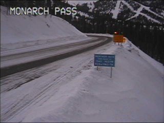 com/colocam-monarch1.htm This pass marks the highest point on US-50, (11,312 ft) and straddles the Continental Divide: The 30 feet of annual snowfall on the east side of the pass ends up in the Atlantic, while (in theory, at least) moisture falling farther west makes its way to the Pacific. 2,000 miles walked from Ocean city, MD, virtually. 1,800 steps per mile x 2,000 miles = 3,600,000 steps, over 200,000 calories burned, about 35 pounds lost + other health benefits, I believe. Learning a lot about the people and places on Route 50. Trip about 2/3 finished. Seems interesting that this mile marker brings me to the Continental Divide and everything now flows to the West.
http://www.dickgilbert.com/colocam-monarch1.htm
 com/colocam-monarch1.htm This pass marks the highest point on US-50, (11,312 ft) and straddles the Continental Divide: The 30 feet of annual snowfall on the east side of the pass ends up in the Atlantic, while (in theory, at least) moisture falling farther west makes its way to the Pacific. 2,000 miles walked from Ocean city, MD, virtually. 1,800 steps per mile x 2,000 miles = 3,600,000 steps, over 200,000 calories burned, about 35 pounds lost + other health benefits, I believe. Learning a lot about the people and places on Route 50. Trip about 2/3 finished. Seems interesting that this mile marker brings me to the Continental Divide and everything now flows to the West.
Monday, February 06, 2006
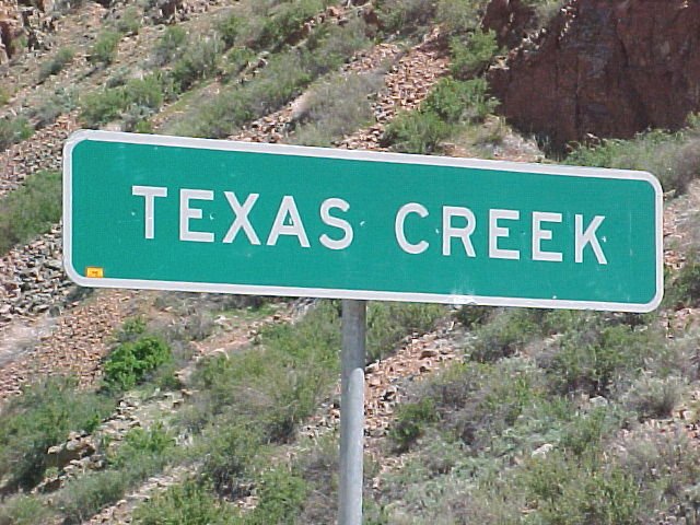
Texas Creek, CO - 1948 miles
Texas Creek is approximately 25 miles west of Canon City and Royal Gorge! (Check out Link).
The town essentially consists of one building that has a restaurant, station and rafting company along Route 50. From Salida (west of Texas Creek) to Canon City, you're in a canyon (photos) with the Arkansas River running along the hi ghway. And here I am on my treadmill. Would really like to actually see this area. In time.
The town essentially consists of one building that has a restaurant, station and rafting company along Route 50. From Salida (west of Texas Creek) to Canon City, you're in a canyon (photos) with the Arkansas River running along the hi
 ghway. And here I am on my treadmill. Would really like to actually see this area. In time.
![]()